
Member Resort
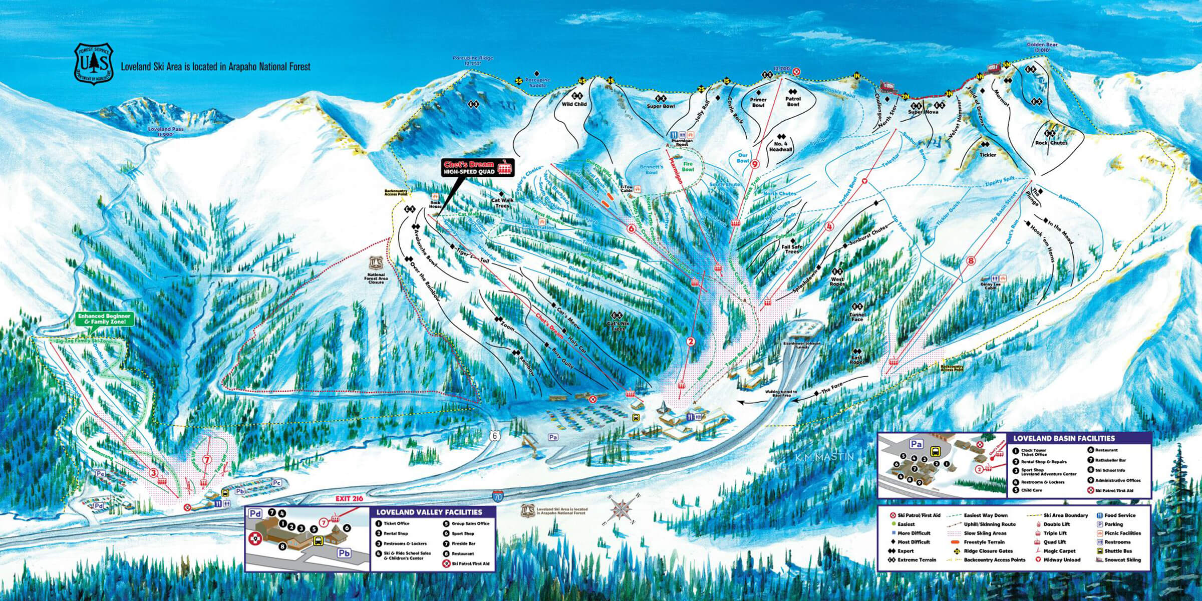
Loveland Ski Area Trail Map
Loveland Ski Area
Loveland Ski Area is a top choice for skiing due to its exceptional snowfall, variety of terrain, and affordable pricing. The area boasts over 1,800 acres of skiable terrain, including both beginner and intermediate options. Loveland's free snowcat service and expert instructors make it an ideal destination for those looking to learn or improve their skiing skills. The scenic views and community vibe add to the charm of this Colorado gem. With its crowd-free atmosphere and family-friendly activities, Loveland Ski Area offers a refreshing and authentic skiing experience.
SnoCountry provides the updated snow reports, weather conditions, and mountain information you need for a great day on the snow at Loveland Ski Area.
SnoCountry provides the updated snow reports, weather conditions, and mountain information you need for a great day on the snow at Loveland Ski Area.
News, Events and Deals
No recent comments, deals, or events available
Weather Forecast
Today
⛅
Partly Cloudy
High: 44°
Low: 23°
Tuesday
🌧️
Rain
High: 35°
Low: 24°
Wednesday
🌧️
Rain
High: 37°
Low: 24°
Thursday
❄️
Snow
High: 34°
Low: 24°
Friday
🌧️
Rain
High: 35°
Low: 26°
Trails Open
Lifts Open
Updated on: 4/6/2026, 4:28:16 AM
Recent Snowfall
Past 24 Hours
-
Snow Comments
8" past 4 days
Past 48 Hours
-
Season Total
160"
Snow Conditions
Primary Surface
Machine Groomed
Secondary Surface
Spring Conditions
Base Depth
34-34"
Status:
Open for Snow Sports
Hours:
Weekend:
Sat/Sun: 8:30a-4p
Weekdays:
Mon-Fri: 9a-4p
Special:
Not available
Resort Stats
Summit Elevation:
12700 ft/3871 m
Base Elevation:
10800 ft/3292 m
Vertical Drop:
1900 ft / 579 m
Skiable Acres:
1800
Total Trails:
94
Total Chairlifts:
10
Uphill Info
Uphill skiing is allowed:
Loveland Ski Area Policy Page
Pass required:
Yes
Routes:
There is one designated route for uphill users: Route A goes to the top of the Ptarmigan Lift. There is a sign on the trail map at the bottom of Lift 2 indicating if Route A is open. Route A goes to the top of Ptarmigan via the following trails: Home Run, Tango Road, turn left up Turtle Creek to Fire Bowl, and continue to the top of Ptarmigan Lift.


