Member Resort
Trail Map
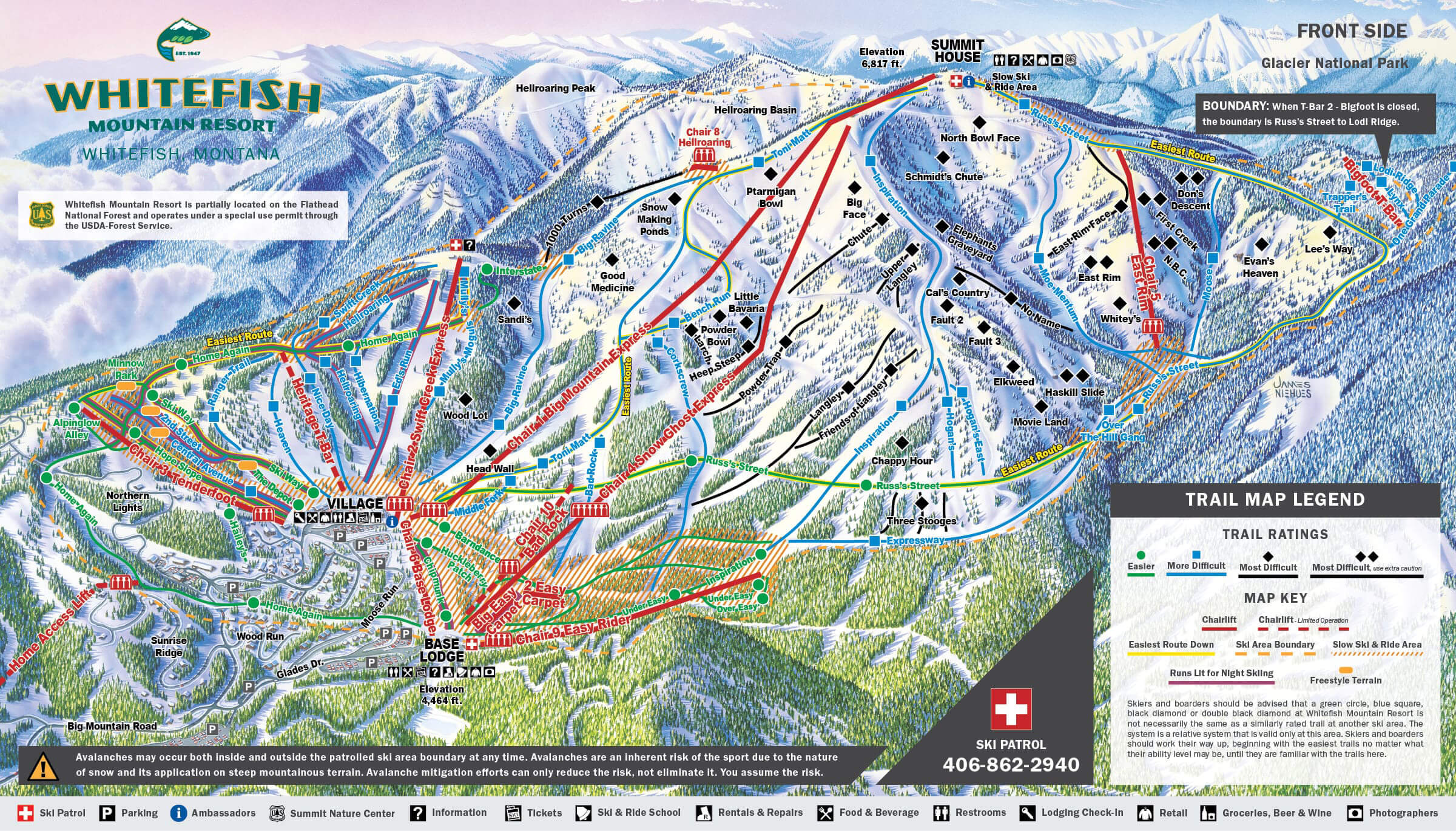
Trail Map
News, Events and Deals
Weather Forecast
Today
☀️
Partly Cloudyx
High: --
Low: --
--
☁️
Cloudy
High: --
Low: --
--
⛅
Partly Sunny
High: 85
Low: 70
--
☁️
Cloudy
High: --
Low: --
--
☀️
Partly Cloudy
High: --
Low: --
Trails Open
Lifts Open
Recent Snowfall
Past 24 Hours
Snow Comments
Past 48 Hours
Season Total
Snow Conditions
Primary Surface
Secondary Surface
Base Depth
Status:
Hours:
Weekend:
Weekdays:
Special:
Resort Stats
Summit Elevation:
Base Elevation:
Vertical Drop:
Skiable Acres:
Total Trails:
Total Chairlifts: